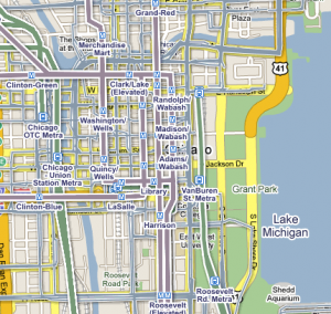
New: Transit layer in Google Maps
The Google Transti trip planner is a great way for people to plan a single transit trip, but what about when you want to get the big picture of transit networks in a given area?
Two weeks ago, Google announced the the addition of a “transit layer” to Google Maps. For the full announcement see New ways to get around with the transit layer (Google LatLong).
Imagine some of the uses: you’re looking to buy a new house, and are most interested in houses near transit to reduce transportation costs and your carbon footprint. Just pull up a Google Maplet for real estate and turn on the transit layer to make your search easy. Or, you’re looking for a hotel to stay in on a business trip, and you’d like to find one within convenient distance of transit to avoid the cost of a car rental: just pull up a map of hotels on Google Maps, turn on the transit layer, and choose a convenient hotel.
Currently, the transit layer is available for about 59 cities. Many, but not all, of these cities participate in the Google Transit trip planner. Not all cities that participate in the Google Transit trip planner are included in the transit layer. I’ve inquired on how Trillium and agencies can ensure that the data we produce will be suitable for use in the Google Maps transit layer, and am awaiting more information.
Below, transit layer for Chicago.
