Google Transit feature: Park and ride / drive to commuter rail
I learned about a new feature in Google Maps/Transit this morning.
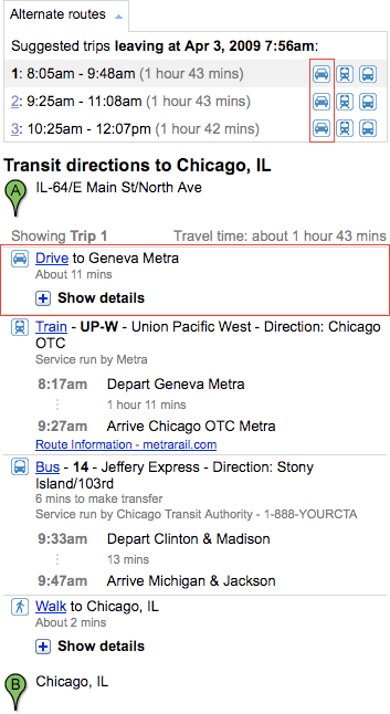
Since many commuter rail services are set up for park and ride, the trip planner will suggest travelers drive to the rail station in some cases.
Here’s an example trip on Chicago’s Metra service (screenshot of itinerary below).

A driving leg to a train station is only offered when there are no feeder bus services in the area.
I am curious to learn more about how this works and see how it will develop. Currently, the trip planner doesn’t return very long driving legs (if you start more than about 4 miles away from a rail station, Google Maps returns a message that transit is not available for the trip). Seems like information about stop features like parking could help here, as well.
It’s very nice to see Google continuing to integrate different modes of travel. It could serve as a gateway for some to experiment with other transportation options.