Google Maps transit directions: select by mode, itinerary preferences
The Google Transit email group periodically has seen requests for a feature to plan rail-only trips, or to express other mode preferences. There have also been requests for features to minimize walking distance or transfers.
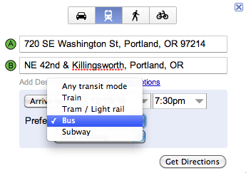
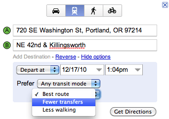
Now, it is possible to express these preferences for transit directions in Google Maps. Users may click the “show options” link immediately beneath the origin and destination text boxes to see drop-down menus for mode and itinerary preferences (screenshot below).


For Google’s announcement see the Google LatLong blog: Directions, the way you want them.
Most of these choices are fairly clear, except for “best route.” What is the best route? Is it a balance between minimal overall travel time, walking distance, and transfers?
One of the first itineraries I looked at with these new features is the intercity itineraries using Oregon’s intercity bus data. I blogged on the long travel itineraries that Google Maps is returning for this dataset. It appears that Google maps continues to generate the same itineraries. In the case of this example, it would be useful to see an option to choose “Shorter travel time” for Google Maps transit directions.
I’d liek to see a “quickest route” option. The “best route” option seems to penalise walk times (probably by a factor of about 1.5).